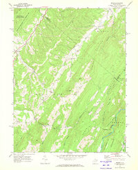
1969 Map of Mozer
USGS Topo · Published 1972About this map
Cave Mtn and Middle Mountain define the high ridges of this Pendleton County landscape, where deep hollows and narrow creek valleys dictate the pattern of human settlement. The rural communities of Brushy Run, Mozer, and Kline are situated along the winding watercourses of North Fork Mill Creek and Mill Run, connected by local roads that follow the natural contours of the land. The presence of multiple country churches, such as South Mill Creek Ch, Mt Horeb Ch, and Trinity Ch, alongside numerous unnamed cemeteries, provides a detailed record of the families who inhabited these valleys. In the east, the Potomac River cuts through the terrain near Sweedlin Valley, while the vast boundaries of the Monongahela National Forest and George Washington National Forest meet across the steep slopes of South Fork Mountain Ridge.
Find a feature on this map
47 named features on this map. Tap any name to fly to it.
Don’t see what you’re looking for? This feature index may not catch every label — zoom into the map to look around manually.
Map Details
Editions of this 1969 Mozer Map
2 editions found
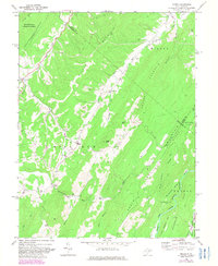
Other maps of this area

1892 · Franklin
USGS Topo · 1:125,000

1896 · Franklin
USGS Topo · 1:125,000

1920 · Petersburg
USGS Topo · 1:48,000

1920 · Onego
USGS Topo · 1:62,500

1921 · Petersburg
USGS Topo · 1:48,000

1921 · Onego
USGS Topo · 1:48,000

1922 · Onego
USGS Topo · 1:62,500

1922 · Fort Seybert
USGS Topo · 1:48,000

1922 · Petersburg
USGS Topo · 1:62,500

1922 · Circleville
USGS Topo · 1:62,500