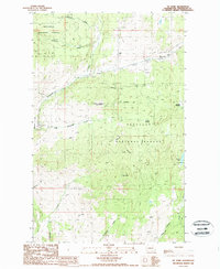
1988 Map of Mt Annie
USGS Topo · Published 1988About this map
Wauconda stands as the primary settlement in this portion of the Okanogan National Forest, situated where several major drainages converge. The landscape is defined by significant elevations, including Mt Annie and Little Bonaparte Mountain, which dictate the paths of numerous seasonal and perennial watercourses like Bonaparte Creek and Lightning Creek. This 1980s survey captures a transition between the high mountain meadows and the working forest, where isolated infrastructure like the Cope Trail and various gravel pits are located. Genealogists and local historians can locate the small Cem north of the main settlement and trace early routes through Suttons Meadow and Bigham Flat. The map provides a detailed view of the drainage network, showing how Labelle Creek and Sourdough Creek feed into the larger regional topography near Turner Lake.
Find a feature on this map
24 named features on this map. Tap any name to fly to it.
Don’t see what you’re looking for? This feature index may not catch every label — zoom into the map to look around manually.
Map Details
Editions of this 1988 Mt Annie Map
This is the sole edition of this map. No revisions or reprints were ever made.
Other maps of this area

1902 · Osoyoos
USGS Topo · 1:125,000

1904 · Osoyoos
USGS Topo · 1:125,000

1904 · Republic
USGS Topo · 1:125,000

1951 · Wauconda
USGS Topo · 1:62,500

1951 · Bodie Mountain
USGS Topo · 1:62,500

1954 · Okanogan
USGS Topo · 1:250,000

1957 · Mt. Bonaparte
USGS Topo · 1:62,500

1957 · Aeneas Valley
USGS Topo · 1:62,500

1958 · Okanogan
USGS Topo · 1:250,000

1958 · Aeneas
USGS Topo · 1:62,500