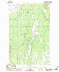
1988 Map of Mt Bonaparte
USGS Topo · Published 1988About this map
Okanogan National Forest dominates this highland landscape, centered on the prominent peak of Mt Bonaparte and its accompanying Lookout Tower. The late-century geography reveals a recreation and resource management focus, with numerous campgrounds clustered around the elongate Bonaparte Lake and smaller Lost Lake. Water sources are densely mapped, from the named Bonaparte Creek to smaller high-elevation points like Lightning Spring and Duff Spring. The network of forestry and access routes includes a Guard Station and a series of tracks, including a designated 4wd route near Myers Creek. In the southeast corner, Walker Lake and Walker Creek provide further drainage, while family-named features like Pettijohn Creek suggest the area's earlier pioneer and ranching heritage.
Find a feature on this map
32 named features on this map. Tap any name to fly to it.
Don’t see what you’re looking for? This feature index may not catch every label — zoom into the map to look around manually.
Map Details
Editions of this 1988 Mt Bonaparte Map
This is the sole edition of this map. No revisions or reprints were ever made.
Other maps of this area

1902 · Osoyoos
USGS Topo · 1:125,000

1904 · Osoyoos
USGS Topo · 1:125,000

1904 · Republic
USGS Topo · 1:125,000

1951 · Wauconda
USGS Topo · 1:62,500

1951 · Bodie Mountain
USGS Topo · 1:62,500

1954 · Okanogan
USGS Topo · 1:250,000

1957 · Mt. Bonaparte
USGS Topo · 1:62,500

1957 · Aeneas Valley
USGS Topo · 1:62,500

1958 · Okanogan
USGS Topo · 1:250,000

1958 · Aeneas
USGS Topo · 1:62,500