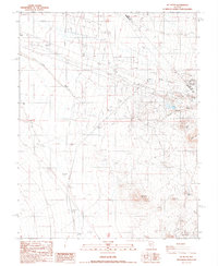
1987 Map of Mt. Butte
USGS Topo · Published 1987About this map
The high desert landscape of Mt Butte and Siebert Mtn dominates this 1987 survey along the border of Nye and Esmeralda counties. This area is characterized by its legacy of mineral exploration, with numerous prospects and specialized operations such as the Hill of Gold Mine and the West Tonopah Mine concentrated in the eastern half of the quadrangle. The transport and utility infrastructure of the era is clearly marked, including a prominent Transmission Line and an extensive Old Railroad Grade that cuts across the northern terrain. Lower-lying drainage patterns like Slime Wash lead toward Alkali Flats, while the presence of Sewage Disposal Ponds and clusters of Trailer Parks near the eastern margin suggest proximity to localized industrial or residential outposts. This provisional mapping captures the industrial footprint of the region before further modern developments altered the surface.
Find a feature on this map
19 named features on this map. Tap any name to fly to it.
Don’t see what you’re looking for? This feature index may not catch every label — zoom into the map to look around manually.
Map Details
Editions of this 1987 Mt. Butte Map
This is the sole edition of this map. No revisions or reprints were ever made.
Other maps of this area

1907 · Tonopah
USGS Topo · 1:250,000

1908 · Lida
USGS Topo · 1:250,000

1908 · Tonopah
USGS Topo · 1:250,000

1913 · Lida
USGS Topo · 1:250,000

1945 · Goldfield
USGS Topo · 1:125,000

1952 · Mud Lake
USGS Topo · 1:62,500

1954 · Goldfield
USGS Topo · 1:250,000

1955 · Goldfield
USGS Topo · 1:250,000

1956 · Tonopah
USGS Topo · 1:250,000

1958 · Goldfield
USGS Topo · 1:250,000