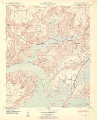
1950 Map of Mt Carmel
USGS Topo · Published 1950About this map
The Tennessee River dominates this mid-century landscape, widening into the Guntersville Reservoir and shaping the development of Marshall County. The topography is defined by the sharp rise of Georgia Mountain and Gunters Mountain, with numerous named hollows like Jagger Hollow and Tidwell Hollow cutting through the slopes. Small agricultural and riverside settlements including Henryville, Manchester, and Cottonville appear alongside local landmarks like Hampton Grove Church and the Simpson Point Church.
Find a feature on this map
81 named features on this map. Tap any name to fly to it.
Don’t see what you’re looking for? This feature index may not catch every label — zoom into the map to look around manually.
Map Details
Editions of this 1950 Mt Carmel Map
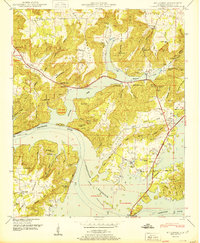
2 editions found
Other maps of this area

1885 · Gadsden
USGS Topo · 1:125,000

1888 · Gadsden
USGS Topo · 1:125,000

1888 · Scottsboro
USGS Topo · 1:125,000

1892 · Scottsboro
USGS Topo · 1:125,000

1892 · Gadsden
USGS Topo · 1:125,000

1895 · Gadsden
USGS Topo · 1:125,000

1903 · Gadsden
USGS Topo · 1:125,000

1936 · Guntersville
USGS Topo · 1:24,000

1936 · Columbus City
USGS Topo · 1:24,000

1936 · New Hope
USGS Topo · 1:24,000