
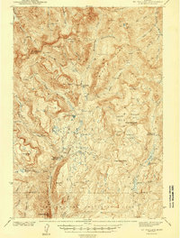
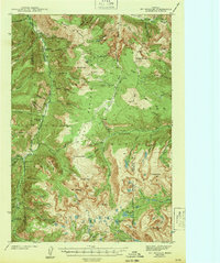
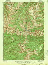
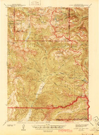
1943 Map of Mt. Cowen
USGS Topo · Published 1943About this map
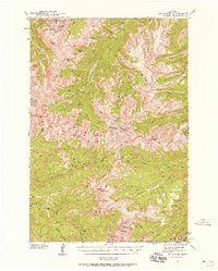
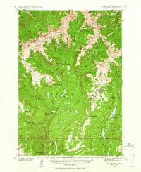
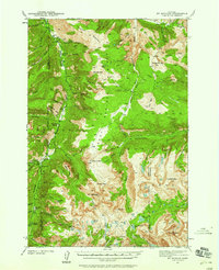
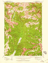
Absaroka National Forest dominates this high-altitude landscape surveyed between 1938 and 1940. The area is defined by its complex drainage systems, including the Boulder River and the West and East Forks that carve through the peaks. High-elevation water bodies like Pine Creek Lake, Jewel Lake, and Trapper Lake sit in the shadows of prominent summits such as Mt Cowen and Black Mtn. The terrain is marked by numerous passes and crossings that indicate early routes through the mountains, notably Mill Creek Pass and Silver Pass. Notable landmarks like Beaver Meadows and the distinctive formation known as The Needles provide clear points of orientation within the wilderness. Names like Agate Springs and Meattrack hint at the seasonal utility and natural resources of the territory during this era of federal land management.
Find a feature on this map
57 named features on this map. Tap any name to fly to it.
Don’t see what you’re looking for? This feature index may not catch every label — zoom into the map to look around manually.
Map Details
Editions of this 1943 Mt. Cowen Map
2 editions found
Other maps of this area

1891 · Livingston
USGS Topo · 1:250,000

1893 · Livingston
USGS Topo · 1:250,000
1940 · Mt. Cowen
USGS Topo · 1:62,500
1940 · Mt Wallace
USGS Topo · 1:62,500
1941 · Mt Douglas
USGS Topo · 1:62,500
1942 · Cutoff Mtn
USGS Topo · 1:62,500
1943 · Mt Wallace
USGS Topo · 1:62,500
1943 · Mt Douglas
USGS Topo · 1:62,500
1943 · Mt Cowen
USGS Topo · 1:62,500
1944 · Cutoff Mtn
USGS Topo · 1:62,500