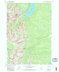
1963 Map of Mt Cramer
USGS Topo · Published 1982About this map
Redfish Lake dominates the northern reaches of this Idaho high-country survey, serving as the central drainage for a complex network of alpine creeks and glacially carved basins. The 1963 field check documents a landscape defined by sharp peaks and deep valleys, including the distinctive Grand Mogul and Finger of Fate. Along the southwestern shore of the main lake, the Redfish Inlet Transfer Camp represents a rare point of human infrastructure in this wilderness, marking the intersection of water-borne travel and terrestrial routes like the Bull Moose Trail.
Find a feature on this map
29 named features on this map. Tap any name to fly to it.
Don’t see what you’re looking for? This feature index may not catch every label — zoom into the map to look around manually.
Map Details
Editions of this 1963 Mt Cramer Map
5 editions found

Other maps of this area

1891 · Bear Valley
USGS Topo · 1:125,000

1893 · Bear Valley
USGS Topo · 1:125,000

1894 · Rocky Bar
USGS Topo · 1:125,000

1900 · Sawtooth
USGS Topo · 1:125,000

1919 · Custer
USGS Topo · 1:125,000

1922 · Custer
USGS Topo · 1:125,000

1955 · Hailey
USGS Topo · 1:250,000

1957 · Challis
USGS Topo · 1:250,000

1959 · Hailey
USGS Topo · 1:250,000

1960 · Challis
USGS Topo · 1:250,000