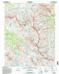
1994 Map of Mt. Darwin
USGS Topo · Published 1997About this map
McClure Meadow Ranger Station stands as a rare outpost of human presence in this high-altitude landscape where the Sierra National Forest meets Kings Canyon National Park. The survey illustrates the complex alpine hydrology of the John Muir Wilderness, where the Glacier Divide separates the Piute Creek drainage from the headwaters of Evolution Creek. This terrain is defined by its massive glacial features, including the Goethe Glacier, Darwin Glacier, and Mt Fiske Glacier. The map traces the critical corridor of the John Muir Trail as it winds through Evolution Valley, passing through Colby Meadow and McClure Meadow. High-altitude routes like the Piute Pass Trail and the crossing at Piute Pass show the established paths used by backcountry travelers to navigate the crest of the Sierra, connecting remote basins such as Darwin Canyon and the Humphreys Basin.
Find a feature on this map
84 named features on this map. Tap any name to fly to it.
Don’t see what you’re looking for? This feature index may not catch every label — zoom into the map to look around manually.
Map Details
Editions of this 1994 Mt. Darwin Map
This is the sole edition of this map. No revisions or reprints were ever made.
Other maps of this area

1912 · Mt. Goddard
USGS Topo · 1:125,000

1947 · Mariposa
USGS Topo · 1:250,000

1948 · Mariposa
USGS Topo · 1:250,000

1948 · Mt. Goddard
USGS Topo · 1:62,500

1949 · Mt. Tom
USGS Topo · 1:62,500

1951 · Mt. Tom
USGS Topo · 1:62,500

1951 · Mt. Goddard
USGS Topo · 1:62,500

1952 · Mt. Goddard
USGS Topo · 1:62,500

1953 · Mt Abbot
USGS Topo · 1:62,500

1953 · Blackcap Mtn
USGS Topo · 1:62,500