
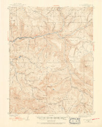
1938 Map of Mt Gunnison
USGS Topo · Published 1968About this map
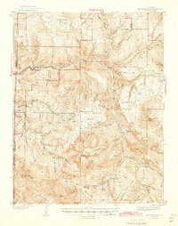
North Fork Gunnison River carves through the heart of this high-country landscape, where the early twentieth-century economies of coal mining and cattle ranching meet. In the western reaches, the industrial nodes of Somerset and Oliver sit along the riverbanks, marking the importance of the valley floor for transportation and resource extraction. The surrounding terrain rises sharply into vast plateaus and mesas, including Coal Creek Mesa and Snowshoe Mesa, which define the region's complex topography.
Find a feature on this map
55 named features on this map. Tap any name to fly to it.
Don’t see what you’re looking for? This feature index may not catch every label — zoom into the map to look around manually.
Map Details
Editions of this 1938 Mt Gunnison Map
5 editions found
Other maps of this area

1888 · Anthracite
USGS Topo · 1:62,500

1889 · Anthracite
USGS Topo · 1:62,500

1893 · Anthracite
USGS Topo · 1:62,500

1894 · Anthracite
USGS Topo · 1:62,500
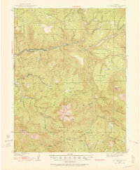
1938 · Mt. Gunnison
USGS Topo · 1:48,000
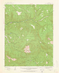
1945 · Mount Gunnison
USGS Topo · 1:62,500

1956 · Montrose
USGS Topo · 1:250,000

1957 · Leadville
USGS Topo · 1:250,000

1959 · Leadville
USGS Topo · 1:250,000

1959 · Montrose
USGS Topo · 1:250,000