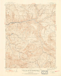
1938 Map of Mount Gunnison
USGS Topo · Published 1952About this map
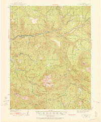
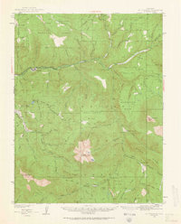
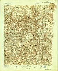
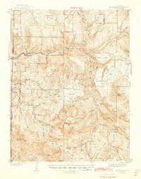
Gunnison National Forest dominates this mid-century survey, where the North Fork Gunnison River carves a path through some of Colorado's most demanding high-country terrain. The settlement of Somerset and the nearby site of Oliver serve as the primary human anchors along the river corridor, while the rest of the landscape is defined by isolated outposts like Roatcap Cabin, Navajo Cabin, and the Minnesota Cow Camp.
Find a feature on this map
99 named features on this map. Tap any name to fly to it.
Don’t see what you’re looking for? This feature index may not catch every label — zoom into the map to look around manually.
Map Details
Editions of this 1938 Mount Gunnison Map
5 editions found

Other maps of this area

1888 · Anthracite
USGS Topo · 1:62,500

1889 · Anthracite
USGS Topo · 1:62,500

1893 · Anthracite
USGS Topo · 1:62,500

1894 · Anthracite
USGS Topo · 1:62,500
1938 · Mt. Gunnison
USGS Topo · 1:48,000
1945 · Mount Gunnison
USGS Topo · 1:62,500

1956 · Montrose
USGS Topo · 1:250,000

1957 · Leadville
USGS Topo · 1:250,000

1959 · Leadville
USGS Topo · 1:250,000

1959 · Montrose
USGS Topo · 1:250,000