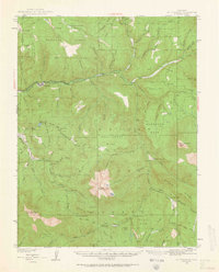
1938 Map of Mount Gunnison
USGS Topo · Published 1963About this map
Somerset serves as the primary gateway to the high-country terrain of the Gunnison National Forest in this 1930s-era survey. The landscape is defined by the drainage of the North Fork Gunnison River and its major tributaries, including Anthracite Creek and Muddy Creek. The region’s agricultural and ranching history is evidenced by remote outposts such as the Minnesota Cow Camp and the Davenport Ranch, while the Munsey-Ruby Stock Driveway traces a traditional route for moving livestock between seasonal pastures.
Find a feature on this map
88 named features on this map. Tap any name to fly to it.
Don’t see what you’re looking for? This feature index may not catch every label — zoom into the map to look around manually.
Map Details
Editions of this 1938 Mount Gunnison Map
5 editions found
Other maps of this area

1888 · Anthracite
USGS Topo · 1:62,500

1889 · Anthracite
USGS Topo · 1:62,500

1893 · Anthracite
USGS Topo · 1:62,500

1894 · Anthracite
USGS Topo · 1:62,500

1938 · Mt. Gunnison
USGS Topo · 1:48,000

1945 · Mount Gunnison
USGS Topo · 1:62,500

1956 · Montrose
USGS Topo · 1:250,000

1957 · Leadville
USGS Topo · 1:250,000

1959 · Leadville
USGS Topo · 1:250,000

1959 · Montrose
USGS Topo · 1:250,000