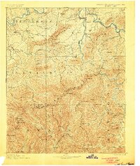
1893 Map of Mt Guyot
USGS Topo · Published 1900About this map
The Tennessee North Carolina Boundary Line snakes across the high peaks of the Smoky Mountains in this late 19th-century survey. Massive landmarks like Mt. Guyot, Clingman Dome, and Le Conte anchor a terrain defined by steep ridges and deep drainage basins. To the north, the French Broad River and Big Pigeon River create corridors for early commerce, notably where the Tennessee and Georgia Railroad meets the settlement at Newport.
Find a feature on this map
112 named features on this map. Tap any name to fly to it.
Don’t see what you’re looking for? This feature index may not catch every label — zoom into the map to look around manually.
Map Details
Editions of this 1893 Mt Guyot Map
3 editions found
Other maps of this area

1883 · Morristown
USGS Topo · 1:125,000

1886 · Knoxville
USGS Topo · 1:125,000

1891 · Cowee
USGS Topo · 1:125,000

1892 · Greeneville
USGS Topo · 1:125,000

1892 · Knoxville
USGS Topo · 1:125,000

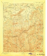
1893 · Mt Guyot
USGS Topo · 1:125,000

1893 · Morristown
USGS Topo · 1:125,000

1894 · Asheville
USGS Topo · 1:125,000

1894 · Knoxville
USGS Topo · 1:125,000

1895 · Morristown
USGS Topo · 1:125,000