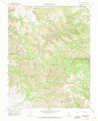
1968 Map of Mt. Harlan
USGS Topo · Published 1971About this map
The Gabilan Range dominates this late-1960s survey, marking the boundary between San Benito and Monterey counties. The landscape is characterized by high peaks and steep canyons, notably Mt Harlan and Bluerock Mtn, which overlook a network of seasonal drainages including Pescadero Creek and Quail Creek. Human presence is sparse, centered on isolated structures like Thompson Cabin and the Rancho Mt Olds to the south. A complex of quarries in the northeast and numerous jeep trails suggest a history of resource extraction and rugged access. The southern portion of the map is defined by the Encinal y Buena Esperanza Grant Bdy, reflecting the enduring legacy of Spanish and Mexican land grants in the California coastal ranges. From the high elevation of Mt Olds to the sheltered Grass Valley, the map details a transitional wilderness between the Salinas Valley and the interior hills.
Find a feature on this map
35 named features on this map. Tap any name to fly to it.
Don’t see what you’re looking for? This feature index may not catch every label — zoom into the map to look around manually.
Map Details
Editions of this 1968 Mt. Harlan Map
2 editions found
Other maps of this area

1910 · Gonzales
USGS Topo · 1:31,680

1910 · Salinas
USGS Topo · 1:31,680

1912 · Salinas
USGS Topo · 1:62,500

1915 · San Juan Bautista
USGS Topo · 1:48,000

1917 · San Juan Bautista
USGS Topo · 1:62,500

1919 · Hollister
USGS Topo · 1:48,000

1921 · Gonzales
USGS Topo · 1:62,500

1921 · Hollister
USGS Topo · 1:62,500

1923 · Hollister
USGS Topo · 1:62,500

1939 · San Juan Bautista
USGS Topo · 1:62,500