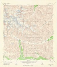
1955 Map of Mt. Hayes A-1
USGS Topo · Published 1965About this map
Tok Glacier dominates the upper reaches of this landscape, its surface marked by extensive crevasses as it carves through the high terrain. The drainage patterns of the Tok River and Dry Tok Creek dictate the topography, eventually leading to Gillett Pass. This mid-century survey captures a remote wilderness primarily accessed via a rudimentary Tractor Trail that skirts the southern valley floors.
Find a feature on this map
12 named features on this map. Tap any name to fly to it.
Don’t see what you’re looking for? This feature index may not catch every label — zoom into the map to look around manually.
Map Details
Editions of this 1955 Mt. Hayes A-1 Map
2 editions found
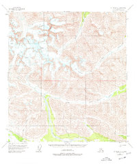
Other maps of this area

1948 · Tanacross A-6
USGS Topo · 1:63,360

1949 · Tanacross
USGS Topo · 1:250,000

1949 · Nabesna D-6
USGS Topo · 1:63,360

1949 · Tanacross B-6
USGS Topo · 1:63,360

1949 · Mt. Hayes A-1
USGS Topo · 1:63,360

1950 · Tanacross
USGS Topo · 1:250,000

1950 · Nabesna
USGS Topo · 1:250,000

1950 · Mount Hayes
USGS Topo · 1:250,000

1951 · Gulkana
USGS Topo · 1:250,000

1951 · Mount Hayes
USGS Topo · 1:250,000