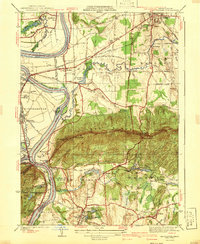
1941 Map of Mt Holyoke
USGS Topo · Published 1941About this map
Amherst College and Mt Holyoke College anchor this detailed study of the Pioneer Valley, where the academic centers of Amherst and South Hadley are connected by a landscape of early industrial sites and diverse terrain. The Connecticut River carves a dramatic path through the center, creating features like the Oxbow and Shepherd Island while serving as the boundary between Hatfield and Hadley. To the south, the dramatic ridgeline of the Holyoke Range rises sharply, punctuated by peaks such as Mt Holyoke, Mt Hitchcock, and Mt Norwottock.
Find a feature on this map
78 named features on this map. Tap any name to fly to it.
Don’t see what you’re looking for? This feature index may not catch every label — zoom into the map to look around manually.
Map Details
Editions of this 1941 Mt Holyoke Map
3 editions found
Other maps of this area

1885 · Northampton
USGS Topo · 1:62,500

1886 · Springfield
USGS Topo · 1:62,500

1886 · Northampton
USGS Topo · 1:62,500

1887 · Palmer
USGS Topo · 1:62,500

1887 · Belchertown
USGS Topo · 1:62,500

1889 · Springfield
USGS Topo · 1:62,500

1889 · Palmer
USGS Topo · 1:62,500

1890 · Belchertown
USGS Topo · 1:62,500

1891 · Northampton
USGS Topo · 1:62,500

1893 · Northampton
USGS Topo · 1:62,500