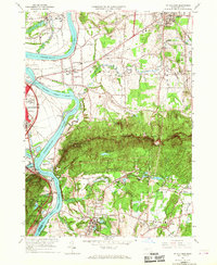
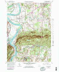
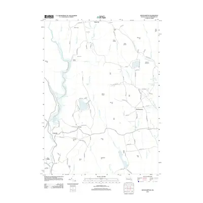
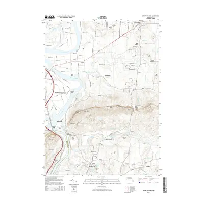
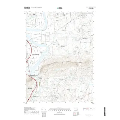
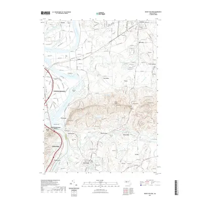
1964 Map of Mt Holyoke
USGS Topo · Published 1967About this map
The Connecticut River dominates this mid-1960s landscape, winding past the notable Oxbow and several river islands including Shepherd Island and Elwell Island. This survey captures the Pioneer Valley as a dense corridor of higher education and agriculture, featuring the expansive campuses of Amherst College and Mt Holyoke College. The dramatic ridgeline of the Holyoke Range cuts across the center, punctuated by Mt Holyoke, Mt Hitchcock, and Mt Norwottock.
Find a feature on this map
99 named features on this map. Tap any name to fly to it.
Don’t see what you’re looking for? This feature index may not catch every label — zoom into the map to look around manually.
Map Details
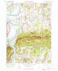
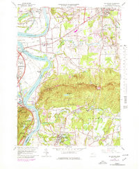
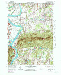
Editions of this 1964 Mt Holyoke Map
7 editions found
Historical Maps of Holyoke Through Time
78 maps found

1886 Chesterfield
Hampshire County, MA

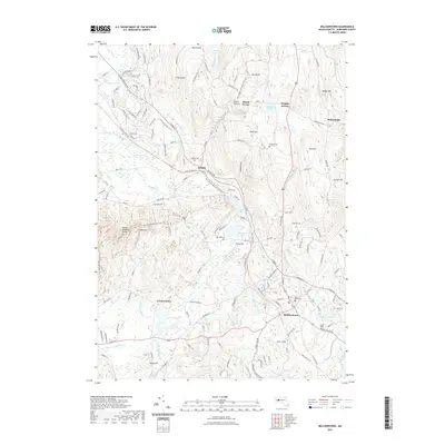
1887 Belchertown
Hampshire County, MA

1888 Chesterfield
Hampshire County, MA

1890 Belchertown
Hampshire County, MA

1893 Belchertown
Hampshire County, MA

1893 Chesterfield
Hampshire County, MA

1895 Chesterfield
Hampshire County, MA

1935 Easthampton
Hampshire County, MA

1935 Mt Holyoke
Hampshire County, MA

1939 Easthampton
Hampshire County, MA

1941 Mt Holyoke
Hampshire County, MA

1942 Belchertown
Hampshire County, MA

1943 Belchertown
Hampshire County, MA

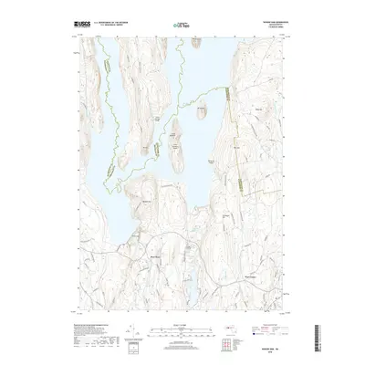
1944 Winsor Dam
Hampshire County, MA

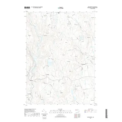
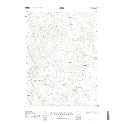
1946 Westhampton
Hampshire County, MA

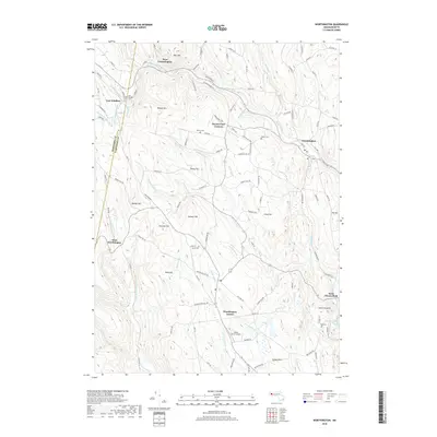
1946 Worthington
Hampshire County, MA

1947 Mt Holyoke
Hampshire County, MA

1947 Westhampton
Hampshire County, MA

1948 Easthampton
Hampshire County, MA

1948 Goshen
Hampshire County, MA

1948 Mt Holyoke
Hampshire County, MA

1949 Belchertown
Hampshire County, MA

1952 Winsor Dam
Hampshire County, MA

1955 Goshen
Hampshire County, MA

1955 Westhampton
Hampshire County, MA

1956 Worthington
Hampshire County, MA

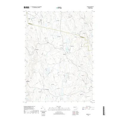
1964 Belchertown
Hampshire County, MA

1964 Easthampton
Hampshire County, MA

1964 Mt Holyoke
Hampshire County, MA

1967 Winsor Dam
Hampshire County, MA

1972 Goshen
Hampshire County, MA

1972 Westhampton
Hampshire County, MA

1972 Worthington
Hampshire County, MA

1975 Belchertown
Hampshire County, MA

1975 Easthampton
Hampshire County, MA

1975 Goshen
Hampshire County, MA

1975 Westhampton
Hampshire County, MA

1975 Winsor Dam
Hampshire County, MA

1975 Worthington
Hampshire County, MA

1987 Chester
Hampshire County, MA

1990 Goshen
Hampshire County, MA

1997 Chester
Hampshire County, MA

1997 Goshen
Hampshire County, MA

2012 Belchertown
Hampshire County, MA

2012 Easthampton
Hampshire County, MA
2012 Goshen
Hampshire County, MA
2012 Mount Holyoke
Hampshire County, MA
2012 Westhampton
Hampshire County, MA

2012 Winsor Dam
Hampshire County, MA
2012 Worthington
Hampshire County, MA
2015 Belchertown
Hampshire County, MA

2015 Easthampton
Hampshire County, MA
2015 Goshen
Hampshire County, MA
2015 Mount Holyoke
Hampshire County, MA
2015 Westhampton
Hampshire County, MA
2015 Winsor Dam
Hampshire County, MA

2015 Worthington
Hampshire County, MA
2018 Belchertown
Hampshire County, MA

2018 Easthampton
Hampshire County, MA
2018 Goshen
Hampshire County, MA
2018 Mount Holyoke
Hampshire County, MA
2018 Westhampton
Hampshire County, MA
2018 Winsor Dam
Hampshire County, MA
2018 Worthington
Hampshire County, MA
2021 Belchertown
Hampshire County, MA

2021 Easthampton
Hampshire County, MA

2021 Goshen
Hampshire County, MA
2021 Mount Holyoke
Hampshire County, MA
2021 Westhampton
Hampshire County, MA

2021 Winsor Dam
Hampshire County, MA

2021 Worthington
Hampshire County, MA

2024 Belchertown
Hampshire County, MA

2024 Easthampton
Hampshire County, MA

2024 Goshen
Hampshire County, MA

2024 Mount Holyoke
Hampshire County, MA

2024 Westhampton
Hampshire County, MA

2024 Winsor Dam
Hampshire County, MA

2024 Worthington
Hampshire County, MA