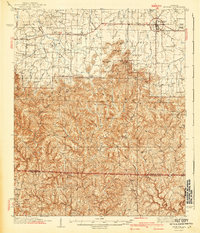
1940 Map of Mt Hope
USGS Topo · Published 1940About this map
Moulton and the surrounding Moulton Valley form the northern anchor of this survey, where the landscape transitions from relatively level agricultural land into the complex ridges of Sand Mountain. The map reveals a high density of rural institutions in the late 1930s, including numerous country schools like Frog Pond Sch and Prospect Sch, alongside many local churches such as Hickory Grove Ch and Owens Chapel.
Find a feature on this map
72 named features on this map. Tap any name to fly to it.
Don’t see what you’re looking for? This feature index may not catch every label — zoom into the map to look around manually.
Map Details
Editions of this 1940 Mt Hope Map
3 editions found

Other maps of this area

1924 · Tuscumbia
USGS Topo · 1:48,000

1926 · Tuscumbia
USGS Topo · 1:62,500

1935 · Moulton
USGS Topo · 1:24,000

1935 · Upshaw
USGS Topo · 1:24,000

1935 · Danville
USGS Topo · 1:48,000

1935 · Oakville
USGS Topo · 1:24,000

1936 · Newburg
USGS Topo · 1:24,000

1936 · Delmar
USGS Topo · 1:24,000

1936 · Kinlock Spring
USGS Topo · 1:24,000

1936 · Caddo
USGS Topo · 1:24,000