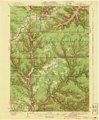
1940 Map of Mt. Jewett
USGS Topo · Published 1940About this map
The Allegheny National Forest dominates the northwestern portion of this 1930s landscape, where a complex network of railways supported the region's timber and industrial base. The Baltimore and Ohio RR and the Erie RR converge at Mt Jewett, a critical junction for the area's commerce. This survey captures the rural infrastructure of Elk and McKean Counties, showing scattered settlements like Wilcox and Johnsonburg along the West Branch Clarion River.
Find a feature on this map
89 named features on this map. Tap any name to fly to it.
Don’t see what you’re looking for? This feature index may not catch every label — zoom into the map to look around manually.
Map Details
Editions of this 1940 Mt. Jewett Map
3 editions found
Other maps of this area

1924 · Bradford
USGS Topo · 1:62,500

1926 · Bradford
USGS Topo · 1:62,500

1933 · Smethport
USGS Topo · 1:62,500

1934 · Kane
USGS Topo · 1:48,000

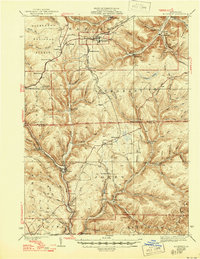
1935 · Mt. Jewett
USGS Topo · 1:48,000

1936 · Kinzua
USGS Topo · 1:48,000

1937 · Smethport
USGS Topo · 1:62,500

1939 · Kane
USGS Topo · 1:62,500

1940 · Hallton
USGS Topo · 1:48,000

1940 · Mt. Jewett
USGS Topo · 1:62,500
Featured Places
- Saint Marys, PA
- Mount Jewett, PA
- Wilcox, Jones Township
- Cartwrights Crossing, Wetmore Township
- Tambine, Jones Township