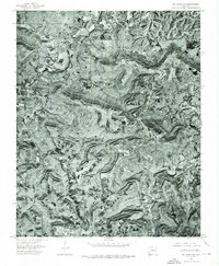
1974 Map of Mt Judea NW
USGS Topo · Published 1975About this map
Parthenon sits within a deeply dissected plateau in Newton County, reflecting the isolated settlement patterns of the Ozarks during the mid-1970s. This orthophotoquad, produced from 1974 aerial photography, reveals the stark contrast between the narrow, fertile valley floors and the densely timbered uplands. The Little Buffalo River snakes through the northern portion of the map, its meandering course carving a distinct path through the rugged topography. For researchers, the high-resolution imagery provides an unfiltered view of the landscape before significant modern changes, showing the exact footprint of small farmsteads, winding country roads, and the cleared bottomlands that supported the local agricultural economy at this time.
Find a feature on this map
2 named features on this map. Tap any name to fly to it.
Don’t see what you’re looking for? This feature index may not catch every label — zoom into the map to look around manually.
Map Details
Editions of this 1974 Mt Judea NW Map
This is the sole edition of this map. No revisions or reprints were ever made.
Other maps of this area

1904 · Harrison
USGS Topo · 1:125,000

1905 · Harrison
USGS Topo · 1:125,000

1933 · Mt Judea
USGS Topo · 1:62,500

1940 · Mt Judea
USGS Topo · 1:62,500

1945 · Harrison
USGS Topo · 1:250,000

1949 · Harrison
USGS Topo · 1:250,000

1954 · Harrison
USGS Topo · 1:250,000

1956 · Russellville
USGS Topo · 1:250,000

1958 · Harrison
USGS Topo · 1:250,000

1964 · Russellville
USGS Topo · 1:250,000