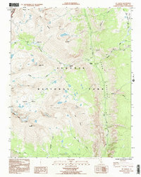
1993 Map of Mt. Kaweah
USGS Topo · Published 1994About this map
Mt Kaweah serves as the focal point of this high-elevation wilderness, where the Sequoia National Park landscape is defined by the convergence of several major drainages. The Kern River canyon cuts deeply through the eastern portion of the sheet, joined by tributaries such as Wallace Creek and Whitney Creek. This 1990s field check records the path of the legendary John Muir Trail and High Sierra Trail, which intersect near Junction Meadow.
Find a feature on this map
28 named features on this map. Tap any name to fly to it.
Don’t see what you’re looking for? This feature index may not catch every label — zoom into the map to look around manually.
Map Details
Editions of this 1993 Mt. Kaweah Map
This is the sole edition of this map. No revisions or reprints were ever made.
Other maps of this area

1903 · Tehipite
USGS Topo · 1:125,000

1904 · Kaweah
USGS Topo · 1:125,000

1905 · Tehipite
USGS Topo · 1:125,000

1905 · Olancha
USGS Topo · 1:125,000

1907 · Olancha
USGS Topo · 1:125,000

1907 · Mt. Whitney
USGS Topo · 1:125,000

1909 · Kaweah
USGS Topo · 1:125,000

1919 · Mt. Whitney
USGS Topo · 1:125,000

1937 · Mt. Whitney
USGS Topo · 1:125,000

1937 · Kaweah
USGS Topo · 1:125,000