
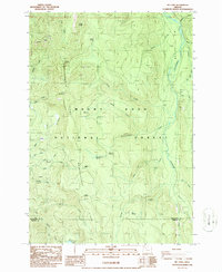
1986 Map of Mt. Lowe
USGS Topo · Published 1994About this map
Mount Hood National Forest terrain dominates this 1980s topographic study, centered on the high divide of Rhododendron Ridge and the prominent peak of Mt Lowe. The landscape is defined by its dramatic drainage networks, where numerous named creeks such as Buckeye Creek and Tumble Creek descend toward the Clackamas River. In the northeastern sector, the river widens into a distinctive area labeled Big Bottom, while the southern reaches capture the confluence of the East Fork Collawash River near the border of Clackamas and Marion Counties. Several meadows, including Jim Meadow, Fawn Meadow, and Rhododendron Meadow, provide evidence of more level openings within the dense forest. Resource extraction is noted through several scattered Borrow Pits and a Quarry near Hunter Ridge, reflecting the practical management of these federal lands during the late twentieth century.
Find a feature on this map
44 named features on this map. Tap any name to fly to it.
Don’t see what you’re looking for? This feature index may not catch every label — zoom into the map to look around manually.
Map Details
Editions of this 1986 Mt. Lowe Map
2 editions found
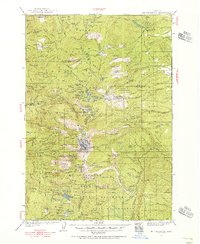
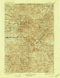
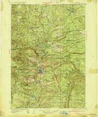
Other maps of this area

1916 · Estacada
USGS Topo · 1:125,000

1924 · Mount Hood
USGS Topo · 1:125,000

1927 · Mount Hood
USGS Topo · 1:125,000
1927 · Mt. Jefferson
USGS Topo · 1:125,000
1929 · Mill City
USGS Topo · 1:125,000
1930 · Mt. Jefferson
USGS Topo · 1:125,000

1948 · Vancouver
USGS Topo · 1:250,000

1950 · Vancouver
USGS Topo · 1:250,000

1950 · Vancouver
USGS Topo · 1:250,000

1953 · Salem
USGS Topo · 1:250,000