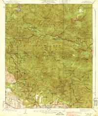
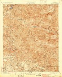
1939 Map of Mt. Lowe
USGS Topo · Published 1939About this map
The San Gabriel Mountains are shown in high detail during the late 1930s, highlighting a landscape defined by forest management and mountain tourism. This survey documents the complex network of firebreaks and fire stations, including Josephine Mtn 5558 Lookout, Waterman Guard Station, and the Arroyo Seco Ranger Station. The presence of the Los Angeles Schools Forestry Center indicates the era's focus on conservation and outdoor education.
Find a feature on this map
47 named features on this map. Tap any name to fly to it.
Don’t see what you’re looking for? This feature index may not catch every label — zoom into the map to look around manually.
Map Details
Editions of this 1939 Mt. Lowe Map
5 editions found
Other maps of this area

1894 · Los Angeles
USGS Topo · 1:62,500

1896 · Pasadena
USGS Topo · 1:62,500

1900 · Pasadena
USGS Topo · 1:62,500

1900 · Tujunga
USGS Topo · 1:62,500

1900 · Los Angeles
USGS Topo · 1:62,500

1901 · Southern California Sheet No. 1
USGS Topo · 1:250,000

1904 · Southern California Sheet No. 1
USGS Topo · 1:250,000
1928 · Altadena
USGS Topo · 1:24,000
1928 · La Crescenta
USGS Topo · 1:24,000
1928 · Sierra Madre
USGS Topo · 1:24,000