
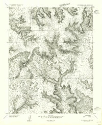
1953 Map of Mt Pennell 2 SE
USGS Topo · Published 1954About this map
Stanton Mine occupies a prominent position in this mid-century survey of Garfield County, marking the industrial footprint of the Henry Mountains region. The landscape is characterized by its high plateaus and drainage systems, where Pennell Creek and Saleratus Creek carve through the sedimentary layers. Mapped using aerial photography taken between 1951 and 1952, this sheet shows a territory defined by distinctive geological formations such as Bedrock Mesa, L-Mac Mesa, and the prominent Ant Knoll. This preliminary edition documents the area before more extensive road networks were established, featuring only a handful of unimproved tracks and water sources like Jackass Spring, which were vital for any localized mining or grazing activity.
Find a feature on this map
7 named features on this map. Tap any name to fly to it.
Don’t see what you’re looking for? This feature index may not catch every label — zoom into the map to look around manually.
Map Details
Editions of this 1953 Mt Pennell 2 SE Map
This is the sole edition of this map. No revisions or reprints were ever made.
Other maps of this area

1886 · Henry Mountains
USGS Topo · 1:250,000

1892 · Henry Mountains
USGS Topo · 1:250,000

1952 · Mt Pennell 1 SW
USGS Topo · 1:24,000

1952 · Mt Pennell 2 NE
USGS Topo · 1:24,000

1952 · Mt Hillers
USGS Topo · 1:62,500

1952 · Mt Pennell 1 NW
USGS Topo · 1:24,000

1953 · Mt Pennell
USGS Topo · 1:62,500

1953 · Mt Pennell 3 NW
USGS Topo · 1:24,000

1953 · Mt Pennell 2 SW
USGS Topo · 1:24,000
1953 · Mt Pennell 2 NW
USGS Topo · 1:24,000