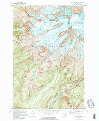
1971 Map of Mt Rainier West
USGS Topo · Published 1996About this map
Mount Rainier and its formidable west-facing glaciers dominate this 1970s topographic study, showcasing the high-altitude environment of Mount Rainier National Park. The landscape is a complex network of icy features, including the Mowich Glacier, Tahoma Glacier, and the precipitous Willis Wall. At the summit, Columbia Crest and Point Success tower over a series of rocky ribs like Puyallup Cleaver and Success Cleaver.
Find a feature on this map
106 named features on this map. Tap any name to fly to it.
Don’t see what you’re looking for? This feature index may not catch every label — zoom into the map to look around manually.
Map Details
Editions of this 1971 Mt Rainier West Map
4 editions found
Other maps of this area

1924 · Mt Rainier
USGS Topo · 1:96,000

1928 · Mt Rainier
USGS Topo · 1:125,000

1950 · Yakima
USGS Topo · 1:250,000

1958 · Yakima
USGS Topo · 1:250,000

1961 · Yakima
USGS Topo · 1:250,000

1962 · Randle
USGS Topo · 1:62,500

1962 · Packwood
USGS Topo · 1:62,500
1971 · Sunrise
USGS Topo · 1:24,000
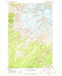
1971 · Mt Rainier West
USGS Topo · 1:24,000
1971 · Mount Wow
USGS Topo · 1:24,000