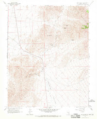
1968 Map of Mt. Schader
USGS Topo · Published 1972About this map
The high desert of the Spring Mountains and the northern reaches of the Pahrump Valley define this late 1960s survey. The landscape is marked by the enduring remains of the regional mining economy, centered on the settlement of Johnnie and the nearby Johnnie Mine. These sites, along with the Labbe Mine and Congress Mine, illustrate the historical extraction efforts that drew people to this arid terrain. A solitary Grave and scattered Prospects further reflect the isolated life of those working the claims. Water sources were vital for survival and industry, evidenced by the presence of Diebert Spring, Kwichup Spring, and Grapevine Springs. Notably, the inclusion of Petroglyphs near Mt Schader hints at a much older history of human presence in the mountains before the mining era.
Find a feature on this map
19 named features on this map. Tap any name to fly to it.
Don’t see what you’re looking for? This feature index may not catch every label — zoom into the map to look around manually.
Map Details
Editions of this 1968 Mt. Schader Map
2 editions found
Other maps of this area

1907 · Las Vegas
USGS Topo · 1:250,000

1908 · Furnace Creek
USGS Topo · 1:250,000

1908 · Las Vegas
USGS Topo · 1:250,000

1910 · Furnace Creek
USGS Topo · 1:250,000

1942 · Indian Spring
USGS Topo · 1:125,000

1942 · Skull Mountain
USGS Topo · 1:125,000

1948 · Death Valley
USGS Topo · 1:250,000

1952 · Specter Range
USGS Topo · 1:62,500

1952 · Mercury
USGS Topo · 1:62,500

1954 · Las Vegas
USGS Topo · 1:250,000