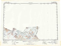
1951 Map of Mt. St. Elias
USGS Topo · Published 1952About this map
Saint Elias Mountains dominate this 1950s reconnaissance, marking the high-altitude boundary between the Third and First Judicial Divisions of Alaska and the Yukon. The map illustrates a landscape of massive ice fields and sharp peaks, where the Malaspina Glacier spreads toward the coast and the Hubbard Glacier terminates near Disenchantment Bay. This survey reflects the complex international border work of the era, pinpointing specific markers such as Boundary Point 187 and Mt Alverstone. The inclusion of features like Moore Nunatak and Blossom I indicates the era's reliance on trimetrogon photography and photoalidade compilation to document terrain where traditional ground surveying was nearly impossible. Notable summits including Mt St Elias and Mt Hubbard anchor the topography, while numerous smaller flows like the Lucia Glacier and Haenke Glacier carve through the Samovar Hills.
Find a feature on this map
48 named features on this map. Tap any name to fly to it.
Don’t see what you’re looking for? This feature index may not catch every label — zoom into the map to look around manually.
Map Details
Editions of this 1951 Mt. St. Elias Map
3 editions found
Other maps of this area

1950 · Bering Glacier
USGS Topo · 1:250,000

1950 · Icy Bay
USGS Topo · 1:250,000

1951 · McCarthy
USGS Topo · 1:250,000

1951 · Icy Bay
USGS Topo · 1:250,000

1951 · Bering Glacier
USGS Topo · 1:250,000

1951 · Yakutat
USGS Topo · 1:250,000

1951 · Mt Saint Elias
USGS Topo · 1:250,000

1952 · Skagway
USGS Topo · 1:250,000

1959 · Yakutat D-3
USGS Topo · 1:63,360

1959 · Yakutat D-4
USGS Topo · 1:63,360