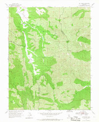
1955 Map of Mt. Stakes
USGS Topo · Published 1963About this map
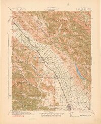
The San Antonio Valley and Upper San Antonio Valley define this landscape along the border of Stanislaus and Santa Clara counties. This mid-century survey reveals a remote pastoral corridor where small pockets of human presence like the Shanti Ashrama and the Harney School sit isolated among the ridgelines. The school is already marked as abandoned by the mid-1950s, reflecting the shifting demographic of this interior range.
Find a feature on this map
39 named features on this map. Tap any name to fly to it.
Don’t see what you’re looking for? This feature index may not catch every label — zoom into the map to look around manually.
Map Details
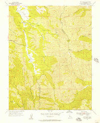
Editions of this 1955 Mt. Stakes Map
3 editions found

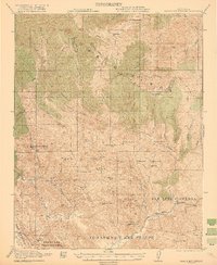
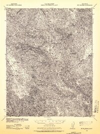
Other maps of this area

1897 · Mt. Hamilton
USGS Topo · 1:62,500

1917 · Morgan Hill
USGS Topo · 1:62,500
1921 · Gilroy Hot Springs
USGS Topo · 1:62,500
1938 · Mt. Boardman
USGS Topo · 1:62,500

1939 · Morgan Hill
USGS Topo · 1:62,500

1939 · Gilroy Hot Springs
USGS Topo · 1:62,500

1940 · Gilroy Hot Springs
USGS Topo · 1:62,500
1941 · Morgan Hill
USGS Topo · 1:62,500

1942 · Mt. Hamilton
USGS Topo · 1:62,500

1942 · Mt. Boardman
USGS Topo · 1:62,500