1902 Map of Mt Stuart
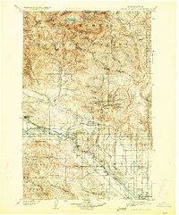
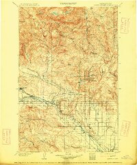
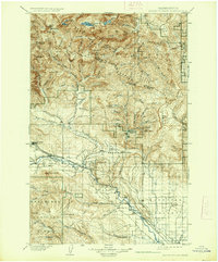
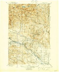
USGS Topo · Published 1927About this map
Ellensburg sits at the base of the fertile Kittitas Valley, serving as the southern anchor for a region transitioning from agricultural plains to high mountain peaks. The late 19th-century survey work reveals an industrial corridor defined by the Northern Pacific R. R. as it follows the river through Thorp, Bristol, and Teanaway toward the coal mining hub of Roslyn. North of the tracks, the landscape rises sharply into the Wenatchee Mountains and the heights of Mt Stuart, where high-altitude features like the Snow Creek Glacier and Twin Lakes dominate. Small mining and timber outposts such as Blewett, Liberty, and Meaghersville are tucked into the drainages of Peshastin Creek and Swauk Creek, illustrating the early 1900s push for mineral extraction in the forested interior of the Wenatchee National Forest.
Find a feature on this map
73 named features on this map. Tap any name to fly to it.
Don’t see what you’re looking for? This feature index may not catch every label — zoom into the map to look around manually.
Map Details
Editions of this 1902 Mt Stuart Map
5 editions found
Other maps of this area

1897 · Mount Stuart
USGS Topo · 1:125,000

1899 · Ellensburg
USGS Topo · 1:125,000

1901 · Chelan
USGS Topo · 1:125,000

1901 · Ellensburg
USGS Topo · 1:125,000

1901 · Chiwaukum
USGS Topo · 1:125,000

1901 · Snoqualmie Pass
USGS Topo · 1:125,000

1902 · Mount Aix
USGS Topo · 1:125,000

1902 · Skykomish
USGS Topo · 1:125,000

1902 · Mount Stuart
USGS Topo · 1:125,000

1903 · Snoqualmie
USGS Topo · 1:125,000