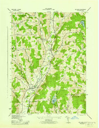
1945 Map of Mt Vision
USGS Topo · Published 1945About this map
Otego Creek and its branches define the drainage of this central New York landscape during the mid-1940s. The settlement pattern reflects a deeply rooted rural community, anchored by the villages of Mt Vision and Laurens. A notable density of local educational infrastructure is evident through the numbering of several rural schoolhouses, including School No 11, School No 5, and School No 13, which once served the surrounding farmsteads.
Find a feature on this map
35 named features on this map. Tap any name to fly to it.
Don’t see what you’re looking for? This feature index may not catch every label — zoom into the map to look around manually.
Map Details
Editions of this 1945 Mt Vision Map
This is the sole edition of this map. No revisions or reprints were ever made.
Other maps of this area

1907 · Cooperstown
USGS Topo · 1:62,500

1909 · Cooperstown
USGS Topo · 1:62,500

1909 · Delhi
USGS Topo · 1:62,500

1910 · Hartwick
USGS Topo · 1:62,500

1911 · Delhi
USGS Topo · 1:62,500

1912 · Hartwick
USGS Topo · 1:62,500

1915 · Oneonta
USGS Topo · 1:62,500

1918 · Oneonta
USGS Topo · 1:62,500

1943 · Mt Vision
USGS Topo · 1:24,000

1943 · Milford
USGS Topo · 1:24,000