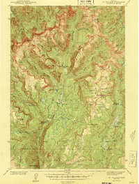
1943 Map of Mt Wallace
USGS Topo · Published 1943About this map
Absaroka National Forest dominates this landscape, where high-altitude ridges and deep basins define the borderlands between Park County and Yellowstone National Park. The survey showcases a primitive infrastructure reliant on isolated outposts like the Hellroaring Ranger Station and Buffalo Fork Ranger Station. These stations, along with the remote Bull Moose Cabin, served as vital hubs for forest management and backcountry travel before modern development reached the high country of the Absaroka Ridge.
Find a feature on this map
56 named features on this map. Tap any name to fly to it.
Don’t see what you’re looking for? This feature index may not catch every label — zoom into the map to look around manually.
Map Details
Editions of this 1943 Mt Wallace Map
3 editions found

Other maps of this area

1885 · Gallatin
USGS Topo · 1:125,000

1885 · Gallatin
USGS Topo · 1:125,000

1886 · Canyon
USGS Topo · 1:125,000

1891 · Livingston
USGS Topo · 1:250,000

1893 · Livingston
USGS Topo · 1:250,000

1895 · Canyon
USGS Topo · 1:125,000

1896 · Canyon
USGS Topo · 1:125,000

1901 · Canyon
USGS Topo · 1:125,000

1901 · Gallatin
USGS Topo · 1:125,000

1907 · Canyon
USGS Topo · 1:125,000