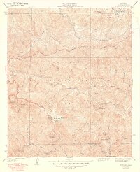
1939 Map of Mt. Wilson
USGS Topo · Published 1948About this map
The Mt Wilson Observatory crowns the peaks of the San Gabriel Mountains in this survey based on fieldwork from the early 1930s. The landscape is defined by the high-elevation crests of San Gabriel Peak, Mt Harvard, and Mt Markham, where a network of firebreaks and the Vetter Mtn Lookout emphasize the vital fire suppression infrastructure within the Angeles National Forest.
Find a feature on this map
36 named features on this map. Tap any name to fly to it.
Don’t see what you’re looking for? This feature index may not catch every label — zoom into the map to look around manually.
Map Details
Editions of this 1939 Mt. Wilson Map
4 editions found
Other maps of this area

1894 · Los Angeles
USGS Topo · 1:62,500

1894 · Pomona
USGS Topo · 1:62,500

1896 · Pasadena
USGS Topo · 1:62,500

1897 · Pomona
USGS Topo · 1:62,500

1898 · Pomona
USGS Topo · 1:62,500

1900 · Pasadena
USGS Topo · 1:62,500

1900 · Tujunga
USGS Topo · 1:62,500

1900 · Los Angeles
USGS Topo · 1:62,500

1901 · Southern California Sheet No. 1
USGS Topo · 1:250,000

1903 · Rock Creek
USGS Topo · 1:62,500