
1939 Map of Mt Wood
USGS Topo · Published 1941About this map
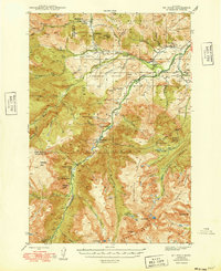
Custer National Forest dominates this 1939 survey, showcasing a landscape of high alpine peaks and deep river valleys where the Stillwater River cuts through the Granite Range. The settlement at Nye serves as a local hub, supported by the Nye Sch and Nye Cem. Economic activity is centered on mineral extraction, evidenced by the Benbow Mine, Mouat Mine, and Tandys Coal Mine scattered across the eastern slopes.
Find a feature on this map
59 named features on this map. Tap any name to fly to it.
Don’t see what you’re looking for? This feature index may not catch every label — zoom into the map to look around manually.
Map Details
Editions of this 1939 Mt Wood Map
4 editions found
Other maps of this area

1891 · Livingston
USGS Topo · 1:250,000

1891 · Big Timber
USGS Topo · 1:125,000

1893 · Livingston
USGS Topo · 1:250,000

1893 · Big Timber
USGS Topo · 1:125,000

1898 · Granite Mountain District
USGS Topo · 1:125,000

1932 · Nye No 1
USGS Topo · 1:48,000

1932 · Nye No 2
USGS Topo · 1:48,000

1941 · Mt. Wood
USGS Topo · 1:62,500

1941 · Mt Douglas
USGS Topo · 1:62,500

1942 · Cutoff Mtn
USGS Topo · 1:62,500