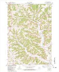
1983 Map of Mt. Zion
USGS Topo · Published 1983About this map
Knapp Creek and its many tributaries, including Jimtown Branch and English Run, carve through a landscape of prominent ridges and deep hollows in this 1983 survey. Small agricultural settlements like Rolling Ground, Tavera, and Mt Zion dot the terrain, reflecting the region's rural character and reliance on a network of narrow valley floors and broad upland ridges. This topography dictated the placement of early infrastructure, from family cemeteries like Mook Cem to educational hubs such as the Orchard View Sch and Scott Sch.
Find a feature on this map
58 named features on this map. Tap any name to fly to it.
Don’t see what you’re looking for? This feature index may not catch every label — zoom into the map to look around manually.
Map Details
Editions of this 1983 Mt. Zion Map
This is the sole edition of this map. No revisions or reprints were ever made.
Other maps of this area

1924 · Gays Mills
USGS Topo · 1:62,500

1926 · Gays Mills
USGS Topo · 1:62,500

1926 · Wauzeka
USGS Topo · 1:62,500

1933 · Boaz
USGS Topo · 1:62,500

1933 · Boscobel
USGS Topo · 1:62,500

1958 · La Crosse
USGS Topo · 1:250,000

1961 · La Crosse
USGS Topo · 1:250,000

1965 · La Crosse
USGS Topo · 1:250,000
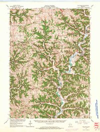
1966 · Gays Mills
USGS Topo · 1:62,500

1966 · Boaz
USGS Topo · 1:62,500