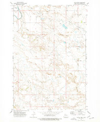
1973 Map of Mud Buttes
USGS Topo · Published 1977About this map
The Little Missouri River snakes through the northwestern corner of this landscape, carving a distinct valley near Sunny Slope. This 1970s survey captures the drainage patterns of Bowman County, where numerous seasonal waterways like Skull Creek, Horse Creek, and Sevenmile Creek dissect the terrain between prominent high points. The map's southern and central reaches are defined by the namesake Mud Buttes and the Rattlesnake Buttes, which serve as significant landmarks for navigation in an area otherwise sparse of human infrastructure. A solitary Landing Strip and a network of unimproved roads provide the few signs of modern development, illustrating the persistent isolation of these badlands. Local history researchers can trace the natural boundaries formed by Fivemile Creek and the intricate contour lines that define the breaks and buttes of this southwestern North Dakota region.
Find a feature on this map
9 named features on this map. Tap any name to fly to it.
Don’t see what you’re looking for? This feature index may not catch every label — zoom into the map to look around manually.
Map Details
Editions of this 1973 Mud Buttes Map
This is the sole edition of this map. No revisions or reprints were ever made.
Other maps of this area

1935 · Buffalo
USGS Topo · 1:125,000

1953 · Dickinson
USGS Topo · 1:250,000

1954 · Lemmon
USGS Topo · 1:250,000

1957 · Dickinson
USGS Topo · 1:250,000

1957 · Lemmon
USGS Topo · 1:250,000

1969 · Table Mountain
USGS Topo · 1:24,000

1973 · Kid Creek
USGS Topo · 1:24,000

1973 · Camel Butte
USGS Topo · 1:24,000

1973 · Cedar Hills
USGS Topo · 1:24,000

1973 · Rhame
USGS Topo · 1:24,000