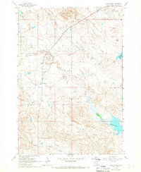
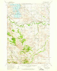
1965 Map of Mud Buttes
USGS Topo · Published 1967About this map
Mud Buttes rise above a landscape defined by the intricate drainage systems of Owl Creek and Bitter Creek in this mid-1960s survey. The terrain is marked by a network of ranching operations that emphasize the area's agricultural character, including the Kiplinger, Beale, and Lietner properties. This era shows a transition in land use near the northern reaches of the Belle Fourche Reservoir, where the water level fluctuates, impacting the surrounding lowlands of Wildcat Creek and Salt Creek.
Find a feature on this map
18 named features on this map. Tap any name to fly to it.
Don’t see what you’re looking for? This feature index may not catch every label — zoom into the map to look around manually.
Map Details
Editions of this 1965 Mud Buttes Map
2 editions found
Other maps of this area

1905 · Saint Onge
USGS Topo · 1:62,500

1905 · Indian
USGS Topo · 1:62,500

1906 · Two Top
USGS Topo · 1:62,500

1907 · Belle Fourche
USGS Topo · 1:125,000

1907 · Redwater
USGS Topo · 1:62,500

1953 · Rapid City
USGS Topo · 1:250,000
1954 · Belle Fourche
USGS Topo · 1:24,000
1954 · Fruitdale
USGS Topo · 1:24,000
1954 · Saint Onge
USGS Topo · 1:62,500

1957 · Rapid City
USGS Topo · 1:250,000