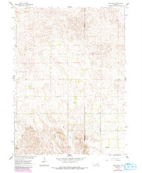
1960 Map of Mud Creek
USGS Topo · Published 1993About this map
Mud Creek meanders through the heart of this landscape, carving a distinct valley through the rolling Sandhills terrain of central Nebraska. This 1960 survey, updated with 1980s aerial data, captures the rural character of the border between Wheeler County and Boone County during a period of steady agricultural use. The arrangement of section lines and simple section-house structures suggests a deeply ingrained township-and-range settlement pattern typical of the Missouri River Basin development era.
Find a feature on this map
4 named features on this map. Tap any name to fly to it.
Don’t see what you’re looking for? This feature index may not catch every label — zoom into the map to look around manually.
Map Details
Editions of this 1960 Mud Creek Map
3 editions found
Other maps of this area

1954 · Spalding
USGS Topo · 1:24,000

1954 · Akron
USGS Topo · 1:24,000

1954 · Spalding NW
USGS Topo · 1:24,000

1955 · Broken Bow
USGS Topo · 1:250,000

1956 · Broken Bow
USGS Topo · 1:250,000

1960 · Spalding 2 SW
USGS Topo · 1:24,000

1960 · Spalding 2 NW
USGS Topo · 1:24,000

1960 · Spalding 2 NE
USGS Topo · 1:24,000

1960 · Spalding 2 SE
USGS Topo · 1:24,000

1963 · Elgin NW
USGS Topo · 1:24,000