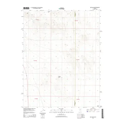
2014 Map of Mud Lake NW
USGS Topo · Published 2014About this map
Klondyke Hills and the Southern Klondyke Hills dominate this portion of the high Nevada desert, providing a detailed look at the relief and terrain south of Tonopah. In a landscape defined by aridity, Gold Reef Spring appears near the base of Gold Mtn, a critical water source for prospectors and wildlife in an otherwise unforgiving environment. The southern edge of the sheet transitions into the vast Ralston Desert, while the primary transportation artery, Highway 95, cuts through the western sections of the map. This 2014 survey documents the enduring physical landmarks of the Silver State's mining heartland, where the proximity of the Esmeralda and Nye County line marks a historically significant boundary for local land claims and historical mapping.
Find a feature on this map
13 named features on this map. Tap any name to fly to it.
Don’t see what you’re looking for? This feature index may not catch every label — zoom into the map to look around manually.
Map Details
Editions of this 2014 Mud Lake NW Map
This is the sole edition of this map. No revisions or reprints were ever made.
Other maps of this area

1907 · Tonopah
USGS Topo · 1:250,000

1908 · Lida
USGS Topo · 1:250,000

1908 · Tonopah
USGS Topo · 1:250,000

1913 · Lida
USGS Topo · 1:250,000

1945 · Goldfield
USGS Topo · 1:125,000

1952 · Mud Lake
USGS Topo · 1:62,500

1954 · Goldfield
USGS Topo · 1:250,000

1955 · Goldfield
USGS Topo · 1:250,000

1956 · Tonopah
USGS Topo · 1:250,000

1958 · Goldfield
USGS Topo · 1:250,000