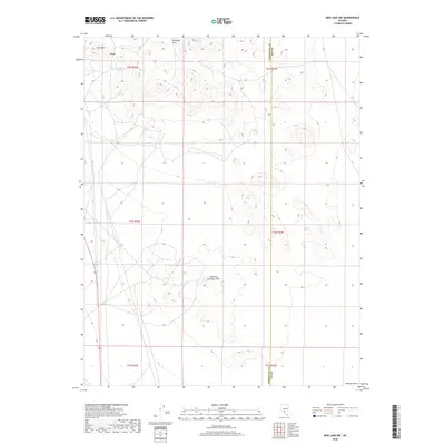
2018 Map of Mud Lake NW
USGS Topo · Published 2018About this map
The Klondyke Hills and Southern Klondyke Hills dominate this section of the Great Basin on the border of Esmeralda and Nye counties. This arid landscape is defined by its topographic extremes, from the heights of Gold Mtn down to the sweeping expanse of the Ralston Desert. The map documents a sparsely populated region where isolated landmarks like Gold Reef Spring and the small settlement of Divide serve as critical points of reference. The layout of the land is heavily influenced by the Public Land Survey System, with township boundaries such as t2n r42e and t1n r43e creating a rigid grid across the undulating basin and range terrain. This 2018 survey provides a precise view of the geographic intersections and traditional desert naming conventions that have persisted in this part of Nevada for generations.
Find a feature on this map
13 named features on this map. Tap any name to fly to it.
Don’t see what you’re looking for? This feature index may not catch every label — zoom into the map to look around manually.
Map Details
Editions of this 2018 Mud Lake NW Map
This is the sole edition of this map. No revisions or reprints were ever made.
Other maps of this area

1907 · Tonopah
USGS Topo · 1:250,000

1908 · Lida
USGS Topo · 1:250,000

1908 · Tonopah
USGS Topo · 1:250,000

1913 · Lida
USGS Topo · 1:250,000

1945 · Goldfield
USGS Topo · 1:125,000

1952 · Mud Lake
USGS Topo · 1:62,500

1954 · Goldfield
USGS Topo · 1:250,000

1955 · Goldfield
USGS Topo · 1:250,000

1956 · Tonopah
USGS Topo · 1:250,000

1958 · Goldfield
USGS Topo · 1:250,000