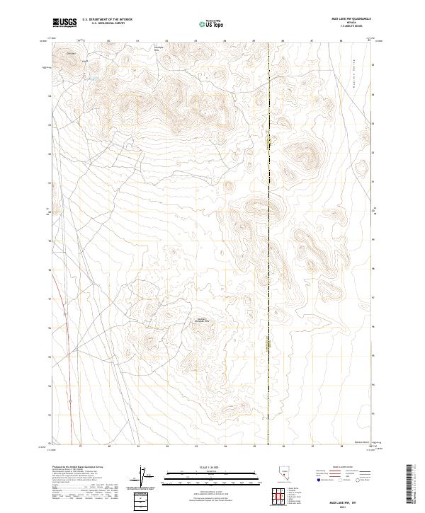
2021 Map of Mud Lake NW
USGS Topo · Published 2021About this map
Klondyke Hills and the Southern Klondyke Hills dominate this high-desert landscape along the border of Esmeralda and Nye Counties. The terrain is defined by dry valleys and isolated peaks, including Gold Mtn and the appropriately named Divide. Water is a scarce and vital resource in this arid environment, marked here only by the presence of Gold Reed Spring. To the east and south, the elevation drops away into the vast expanses of Ralston Valley and the Ralston Desert. The map reveals the stark, open character of this section of the Great Basin, where land boundaries follow the rigid Township and Range system across a landscape of ancient rock and shifting sands.
Find a feature on this map
14 named features on this map. Tap any name to fly to it.
Don’t see what you’re looking for? This feature index may not catch every label — zoom into the map to look around manually.
Map Details
Editions of this 2021 Mud Lake NW Map
This is the sole edition of this map. No revisions or reprints were ever made.
Other maps of this area

1907 · Tonopah
USGS Topo · 1:250,000

1908 · Lida
USGS Topo · 1:250,000

1908 · Tonopah
USGS Topo · 1:250,000

1913 · Lida
USGS Topo · 1:250,000

1945 · Goldfield
USGS Topo · 1:125,000

1952 · Mud Lake
USGS Topo · 1:62,500

1954 · Goldfield
USGS Topo · 1:250,000

1955 · Goldfield
USGS Topo · 1:250,000

1956 · Tonopah
USGS Topo · 1:250,000

1958 · Goldfield
USGS Topo · 1:250,000