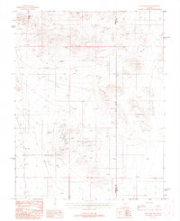
1987 Map of Mud Lake NW
USGS Topo · Published 1988About this map
Mining operations dominate this arid expanse of the Great Basin along the Esmeralda Co Nye Co line. The landscape is heavily marked by late-twentieth-century extraction efforts, featuring high-interest sites for researchers such as the Silver King Mine and the Gold Seam Mine. Countless prospects, adits, and mine shafts pepper the terrain, illustrating the persistent search for mineral wealth across this high-desert region. An indefinite boundary snakes through the topography, while a gravel pit and numerous scattered adit and prospect labels indicate a landscape of ongoing industrial utility. This map captures the industrial character of the Nevada desert during the mid-1980s, documenting the specific locations of many smaller, unnamed mining attempts alongside established operations.
Find a feature on this map
13 named features on this map. Tap any name to fly to it.
Don’t see what you’re looking for? This feature index may not catch every label — zoom into the map to look around manually.
Map Details
Editions of this 1987 Mud Lake NW Map
This is the sole edition of this map. No revisions or reprints were ever made.
Other maps of this area

1907 · Tonopah
USGS Topo · 1:250,000

1908 · Lida
USGS Topo · 1:250,000

1908 · Tonopah
USGS Topo · 1:250,000

1913 · Lida
USGS Topo · 1:250,000

1945 · Goldfield
USGS Topo · 1:125,000

1952 · Mud Lake
USGS Topo · 1:62,500

1954 · Goldfield
USGS Topo · 1:250,000

1955 · Goldfield
USGS Topo · 1:250,000

1956 · Tonopah
USGS Topo · 1:250,000

1958 · Goldfield
USGS Topo · 1:250,000