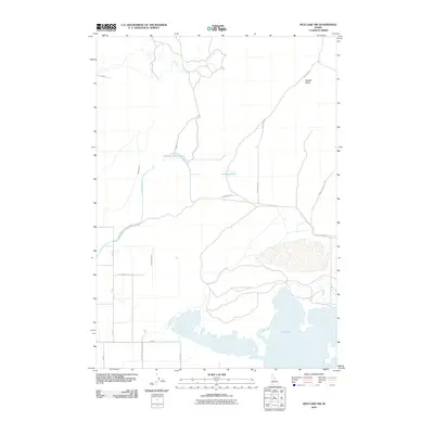
2010 Map of Mud Lake NW
USGS Topo · Published 2010About this map
The northern reaches of Mud Lake dominate this high-desert landscape in Jefferson County, where water management is the defining human footprint. A sophisticated network of irrigation infrastructure is visible, including the Owsley Canal, Jefferson Canal, and Mitchell Ditch, which redirect water across the arid plains to support local agriculture. The terrain is marked by solitary geological features and modest water bodies like Johnston Lake and the Jefferson Reservoir. To the northeast, Needle Butte provides a significant landmark in an otherwise level topography. The presence of these named canals and ditches indicates the intensive 20th-century effort to reclaim this portion of the Snake River Plain for productive use, while roads like Jefferson Rd and E North Lake Rd connect the scattered water works and rural sections.
Find a feature on this map
18 named features on this map. Tap any name to fly to it.
Don’t see what you’re looking for? This feature index may not catch every label — zoom into the map to look around manually.
Map Details
Editions of this 2010 Mud Lake NW Map
This is the sole edition of this map. No revisions or reprints were ever made.
Other maps of this area

1955 · Dubois
USGS Topo · 1:250,000

1955 · Idaho Falls
USGS Topo · 1:250,000

1958 · Dubois
USGS Topo · 1:250,000

1958 · Idaho Falls
USGS Topo · 1:250,000

1964 · Terreton
USGS Topo · 1:24,000

1964 · Cedar Butte SW
USGS Topo · 1:24,000

1964 · Mud Lake SE
USGS Topo · 1:24,000

1964 · Mud Lake NW
USGS Topo · 1:24,000

1964 · Rays Lake
USGS Topo · 1:24,000

1964 · Cedar Butte SE
USGS Topo · 1:24,000