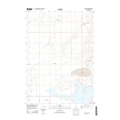
2013 Map of Mud Lake NW
USGS Topo · Published 2013About this map
Mud Lake and the surrounding high desert of Jefferson County are defined by a complex network of water management features as they appeared in 2013. The landscape is heavily structured by irrigation projects including the Jefferson Canal, Owsley Canal, and Mitchell Ditch, which redirect water across the arid terrain to support local agriculture. The hydrology is further marked by the Jefferson Reservoir and Johnston Lake, while the north-central area contains the prominent basin of North Lake.
Find a feature on this map
30 named features on this map. Tap any name to fly to it.
Don’t see what you’re looking for? This feature index may not catch every label — zoom into the map to look around manually.
Map Details
Editions of this 2013 Mud Lake NW Map
This is the sole edition of this map. No revisions or reprints were ever made.
Other maps of this area

1955 · Dubois
USGS Topo · 1:250,000

1955 · Idaho Falls
USGS Topo · 1:250,000

1958 · Dubois
USGS Topo · 1:250,000

1958 · Idaho Falls
USGS Topo · 1:250,000

1964 · Terreton
USGS Topo · 1:24,000

1964 · Cedar Butte SW
USGS Topo · 1:24,000

1964 · Mud Lake SE
USGS Topo · 1:24,000

1964 · Mud Lake NW
USGS Topo · 1:24,000

1964 · Rays Lake
USGS Topo · 1:24,000

1964 · Cedar Butte SE
USGS Topo · 1:24,000