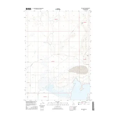
2017 Map of Mud Lake NW
USGS Topo · Published 2017About this map
Mud Lake and its surrounding wetlands define this corner of Jefferson County, where complex irrigation systems support a landscape of managed water. The presence of the Owsley Canal, Jefferson Canal, and smaller waterways like McKevitt Ditch and Mitchell Ditch illustrate the long-standing efforts to reclaim and utilize the high desert terrain. These man-made features connect natural and artificial reservoirs, including the Jefferson Reservoir and Johnston Lake, which sit northwest of the main lake basin.
Find a feature on this map
25 named features on this map. Tap any name to fly to it.
Don’t see what you’re looking for? This feature index may not catch every label — zoom into the map to look around manually.
Map Details
Editions of this 2017 Mud Lake NW Map
This is the sole edition of this map. No revisions or reprints were ever made.
Other maps of this area

1955 · Dubois
USGS Topo · 1:250,000

1955 · Idaho Falls
USGS Topo · 1:250,000

1958 · Dubois
USGS Topo · 1:250,000

1958 · Idaho Falls
USGS Topo · 1:250,000

1964 · Terreton
USGS Topo · 1:24,000

1964 · Cedar Butte SW
USGS Topo · 1:24,000

1964 · Mud Lake SE
USGS Topo · 1:24,000

1964 · Mud Lake NW
USGS Topo · 1:24,000

1964 · Rays Lake
USGS Topo · 1:24,000

1964 · Cedar Butte SE
USGS Topo · 1:24,000