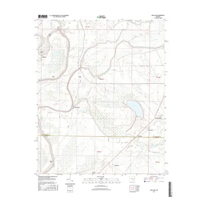
2017 Map of Mud Lake
USGS Topo · Published 2017About this map
Saint Francis River and its intricate drainage system dominate this portion of the Arkansas Delta, where low-lying wetlands are punctuated by meandering bayous and small agricultural settlements. The landscape is defined by its relation to water, featuring prominent bends and bars such as Horseshoe Bend, Council Bar, and Walling Bar. Small rural communities including Rawlinson, Lakeside, and Bledsoe are scattered along the county roads, reflecting a settlement pattern tied to the fertile but flood-prone alluvial plain.
Find a feature on this map
53 named features on this map. Tap any name to fly to it.
Don’t see what you’re looking for? This feature index may not catch every label — zoom into the map to look around manually.
Map Details
Editions of this 2017 Mud Lake Map
This is the sole edition of this map. No revisions or reprints were ever made.
Other maps of this area

1931 · Horseshoe Lake
USGS Topo · 1:62,500

1939 · Horseshoe Lake
USGS Topo · 1:62,500

1939 · Park Place
USGS Topo · 1:62,500

1939 · Edmondson
USGS Topo · 1:62,500

1940 · Whitmore
USGS Topo · 1:62,500

1948 · Helena
USGS Topo · 1:250,000

1950 · Helena
USGS Topo · 1:250,000

1953 · Memphis
USGS Topo · 1:250,000

1954 · Horseshoe Lake
USGS Topo · 1:62,500

1954 · Edmondson
USGS Topo · 1:62,500