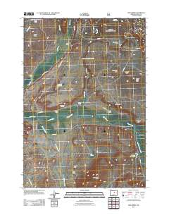
2011 Map of Mud Spring
USGS Topo · Published 2011About this map
Beaver Creek Cemetery sits at the heart of this high-desert ranching landscape in Crook County, where early 21st-century surveys document a network of established homesteads and water management. The terrain is defined by prominent volcanic features and escarpments, including Rattlesnake Butte, Laughlin Table, and the dramatic Cordella Rim. A system of seasonal and perennial waters like Beaver Creek and Grindstone Creek support numerous working ranches, such as Miller Ranch and Lister Ranch. The infrastructure reflects a reliance on carefully managed resources, evidenced by the Marshy Reservoir and Palmer Reservoir. From Logan Ridge in the northwest to Mud Spring Butte in the south, the map details the rugged topography and rural road systems, including SE Lister Rd and the Paulina Suplee Hwy, that connect these isolated agricultural operations.
Find a feature on this map
39 named features on this map. Tap any name to fly to it.
Don’t see what you’re looking for? This feature index may not catch every label — zoom into the map to look around manually.
Map Details
Editions of this 2011 Mud Spring Map
This is the sole edition of this map. No revisions or reprints were ever made.
Other maps of this area

1932 · Dayville
USGS Topo · 1:125,000

1936 · Dayville
USGS Topo · 1:125,000

1955 · Canyon City
USGS Topo · 1:250,000

1959 · Canyon City
USGS Topo · 1:250,000

1966 · Little Summit Prairie
USGS Topo · 1:24,000

1966 · Six Corners
USGS Topo · 1:24,000

1972 · Wolf Mountain
USGS Topo · 1:24,000
1981 · Powell Mtn
USGS Topo · 1:24,000

1981 · Suplee
USGS Topo · 1:24,000

1981 · Dayville
USGS Topo · 1:100,000