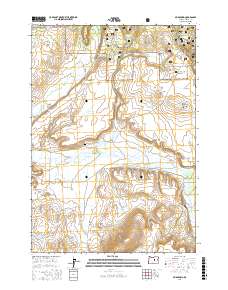
2017 Map of Mud Spring
USGS Topo · Published 2017About this map
Ochoco National Forest land dominates the northern portion of this Crook County landscape, where the high desert terrain transitions into timbered ridges and open flats. The mapping provides a detailed look at the water sources critical to this arid environment, including Mud Spring, Widow Spring, and Jumper Basin Spring, which feed the drainages of Beaver Cr and its northern and southern forks. For genealogists and local historians, the Beaver Creek Cem stands as a significant point of reference amidst the sprawling topography of Powell Valley and the Laughlin Table. A network of forest roads and land management routes, such as Rager Rd and Wolf Cr Rd, provides access to landmarks like Rattlesnake Butte and Sheepshooter Ridge, illustrating the modern management and accessibility of this expansive cattle and timber country.
Find a feature on this map
47 named features on this map. Tap any name to fly to it.
Don’t see what you’re looking for? This feature index may not catch every label — zoom into the map to look around manually.
Map Details
Editions of this 2017 Mud Spring Map
This is the sole edition of this map. No revisions or reprints were ever made.
Other maps of this area

1932 · Dayville
USGS Topo · 1:125,000

1936 · Dayville
USGS Topo · 1:125,000

1955 · Canyon City
USGS Topo · 1:250,000

1959 · Canyon City
USGS Topo · 1:250,000

1966 · Little Summit Prairie
USGS Topo · 1:24,000

1966 · Six Corners
USGS Topo · 1:24,000

1972 · Wolf Mountain
USGS Topo · 1:24,000
1981 · Powell Mtn
USGS Topo · 1:24,000

1981 · Suplee
USGS Topo · 1:24,000

1981 · Dayville
USGS Topo · 1:100,000