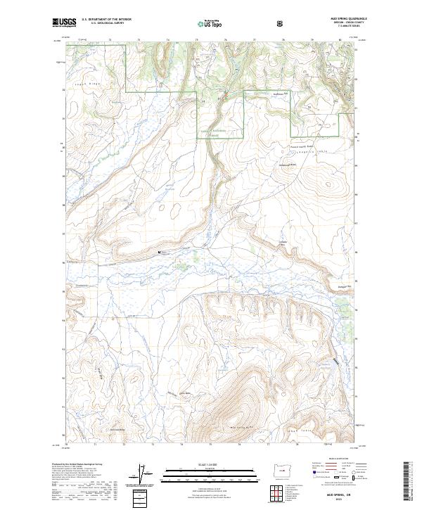
2023 Map of Mud Spring
USGS Topo · Published 2023About this map
Ochoco National Forest lands dominate the northern landscape of this Crook County region, where the high desert terrain transitions into a complex system of rims and tables. The southern portion of the map is defined by prominent basalt features such as Dahlgren Rim and Cordella Rim, which overlook the winding course of Beaver Creek and its many seasonal tributaries. A quiet history of ranching and early settlement is evident at the Beaver Creek Cem, situated near Lister Rd. Water remains the central character of this arid environment, marked by isolated points like Mud Spring and Juniper Basin Spring, and man-made catchments like Marshy Reservoir. Cattle roads and forest routes, including SE Durgan Ranch Rd and Rager Rd, provide the primary network through this high-elevation plateau.
Find a feature on this map
46 named features on this map. Tap any name to fly to it.
Don’t see what you’re looking for? This feature index may not catch every label — zoom into the map to look around manually.
Map Details
Editions of this 2023 Mud Spring Map
This is the sole edition of this map. No revisions or reprints were ever made.
Other maps of this area

1932 · Dayville
USGS Topo · 1:125,000

1936 · Dayville
USGS Topo · 1:125,000

1955 · Canyon City
USGS Topo · 1:250,000

1959 · Canyon City
USGS Topo · 1:250,000

1966 · Little Summit Prairie
USGS Topo · 1:24,000

1966 · Six Corners
USGS Topo · 1:24,000

1972 · Wolf Mountain
USGS Topo · 1:24,000
1981 · Powell Mtn
USGS Topo · 1:24,000

1981 · Suplee
USGS Topo · 1:24,000

1981 · Dayville
USGS Topo · 1:100,000