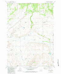
1983 Map of Mud Spring
USGS Topo · Published 1983About this map
Ochocco National Forest dominates the northern reaches of this Crook County landscape, where the high plateau transitions into rugged drainages. The map reveals a land defined by early ranching operations, with family-named homesteads such as Miller Ranch, Lister Ranch, and Laughlin Ranch scattered along the watercourses. These sites reflect the settlement patterns of central Oregon's high desert, where access to water from Grindstone Creek, Beaver Creek, and various springs was the primary driver of land use.
Find a feature on this map
44 named features on this map. Tap any name to fly to it.
Don’t see what you’re looking for? This feature index may not catch every label — zoom into the map to look around manually.
Map Details
Editions of this 1983 Mud Spring Map
This is the sole edition of this map. No revisions or reprints were ever made.
Other maps of this area

1932 · Dayville
USGS Topo · 1:125,000

1936 · Dayville
USGS Topo · 1:125,000

1955 · Canyon City
USGS Topo · 1:250,000

1959 · Canyon City
USGS Topo · 1:250,000

1966 · Little Summit Prairie
USGS Topo · 1:24,000

1966 · Six Corners
USGS Topo · 1:24,000

1972 · Wolf Mountain
USGS Topo · 1:24,000
1981 · Powell Mtn
USGS Topo · 1:24,000

1981 · Suplee
USGS Topo · 1:24,000

1981 · Dayville
USGS Topo · 1:100,000