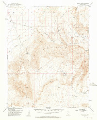
1953 Map of Muddy Peak
USGS Topo · Published 1964About this map
Valley of Fire and the surrounding desert landscape dominate this mid-century survey of Clark County. The region's industrial footprint is clearly marked by the American Borax Co Mines and the American Borax Road cutting through White Basin, while the Colorock Quarry appears further west. These extraction sites are tied to the terrain by a network of historic routes including the Arrowhead Trail and the road to Kaolin.
Find a feature on this map
33 named features on this map. Tap any name to fly to it.
Don’t see what you’re looking for? This feature index may not catch every label — zoom into the map to look around manually.
Map Details
Editions of this 1953 Muddy Peak Map
3 editions found
Other maps of this area

1886 · Saint Thomas
USGS Topo · 1:250,000

1893 · Saint Thomas
USGS Topo · 1:250,000

1926 · Bonelli
USGS Topo · 1:96,000

1926 · Boulder Canyon
USGS Topo · 1:96,000

1952 · Dry Lake
USGS Topo · 1:62,500

1952 · Henderson
USGS Topo · 1:62,500

1953 · Muddy Peak
USGS Topo · 1:62,500

1953 · Overton Beach
USGS Topo · 1:62,500

1953 · Hoover Dam
USGS Topo · 1:62,500

1953 · Virgin Basin
USGS Topo · 1:62,500