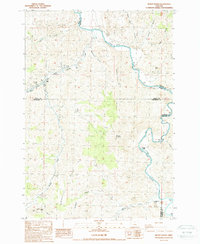
1987 Map of Muddy Ranch
USGS Topo · Published 1988About this map
Muddy Ranch and its neighboring agricultural operations define this high-desert landscape where Wasco, Wheeler, and Jefferson counties converge. The winding John Day River carves a deep path through the terrain, flanked by significant elevation gains at Melendy Ridge and Wagner Mountain. This 1980s field check records a series of established ranching outposts, including Wagner Ranch and Cherry Creek Ranch, illustrating the continued importance of river access and creek drainage in this arid region.
Find a feature on this map
37 named features on this map. Tap any name to fly to it.
Don’t see what you’re looking for? This feature index may not catch every label — zoom into the map to look around manually.
Map Details
Editions of this 1987 Muddy Ranch Map
This is the sole edition of this map. No revisions or reprints were ever made.
Other maps of this area

1926 · Mitchell
USGS Topo · 1:125,000

1955 · Bend
USGS Topo · 1:250,000

1957 · Bend
USGS Topo · 1:250,000

1958 · Bend
USGS Topo · 1:250,000

1966 · Antelope
USGS Topo · 1:62,500

1966 · Clarno
USGS Topo · 1:62,500

1968 · Horse Heaven Creek
USGS Topo · 1:24,000

1968 · Painted Hills
USGS Topo · 1:24,000
1968 · Sandrock Mtn
USGS Topo · 1:24,000

1981 · Stephenson Mountain
USGS Topo · 1:100,000